References
Here are some examples from various projects and products with photos, screenshots and brief explanations.
Traffic management information system for broadcasters
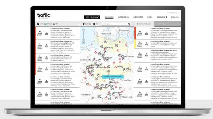
Software system with connection to the state reporting offices (police traffic situation) in Germany. The data is automatically pre-evaluated and enriched with structured geo-information. The data is then automatically submitted to the traffic editors of the radio stations. Information is automatically allocated according to responsibility (only reports on the situation in defined broadcasting areas).
Public transport stops information system
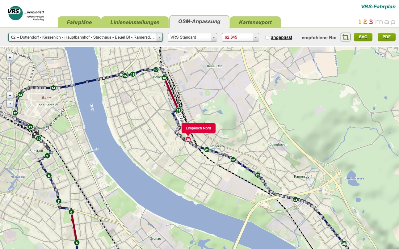
Software system with connection to transport association's database for manual and/or automatic generation of bus stop notices
CAPITAL - Real Estate Compass
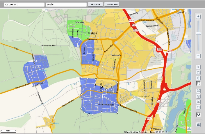
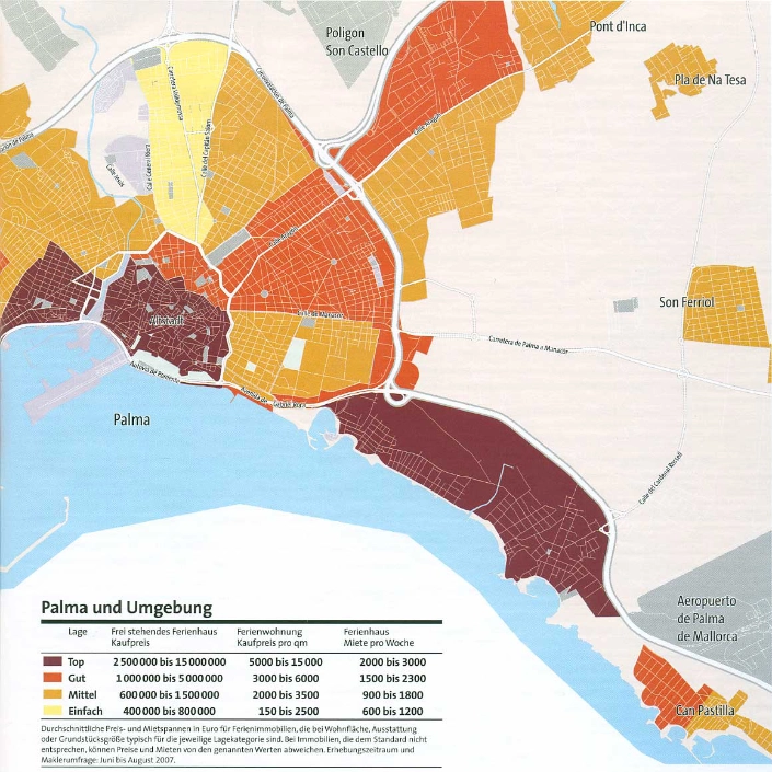
Interactive browser application for recording price areas for the Capital Real Estate Compass
Gelbe Seiten - hannover.de (Yellow Pages)
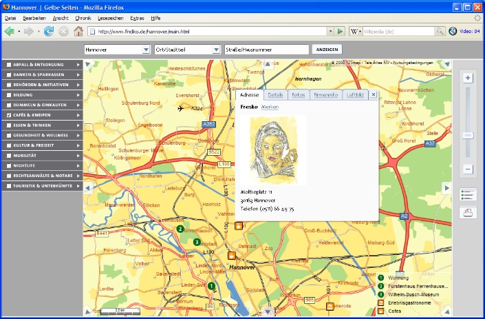
Interactive city map on hannover.de with business information from the Yellow Pages
Energy saving network
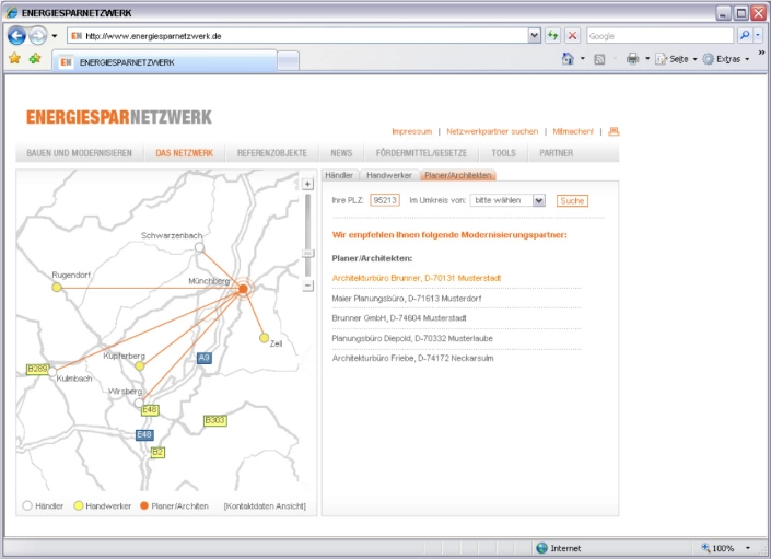
Dynamic visualization of 1:n networks on a map
Hiking map from a professional
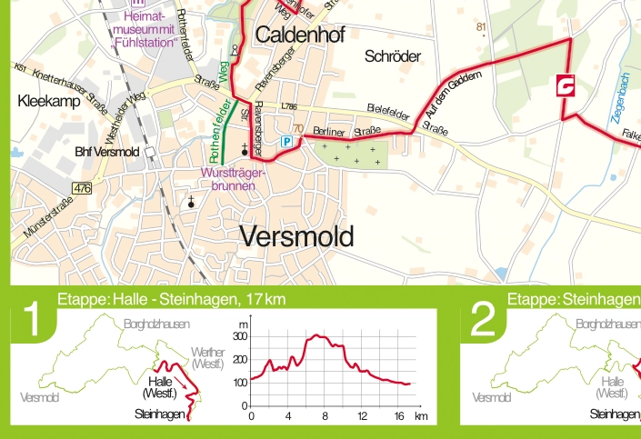
Print map from our store, reworked by a cartographer
Sparkassen News Paper
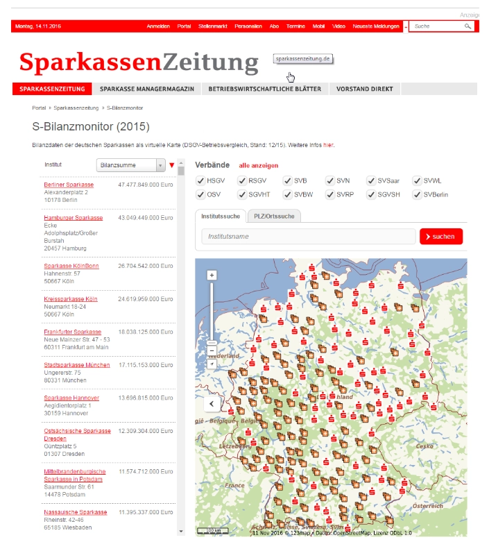
Interaktive Karte zu Kennzahlen von Sparkasseninstituten
Real-time tracking of CeBIT trade fair buses
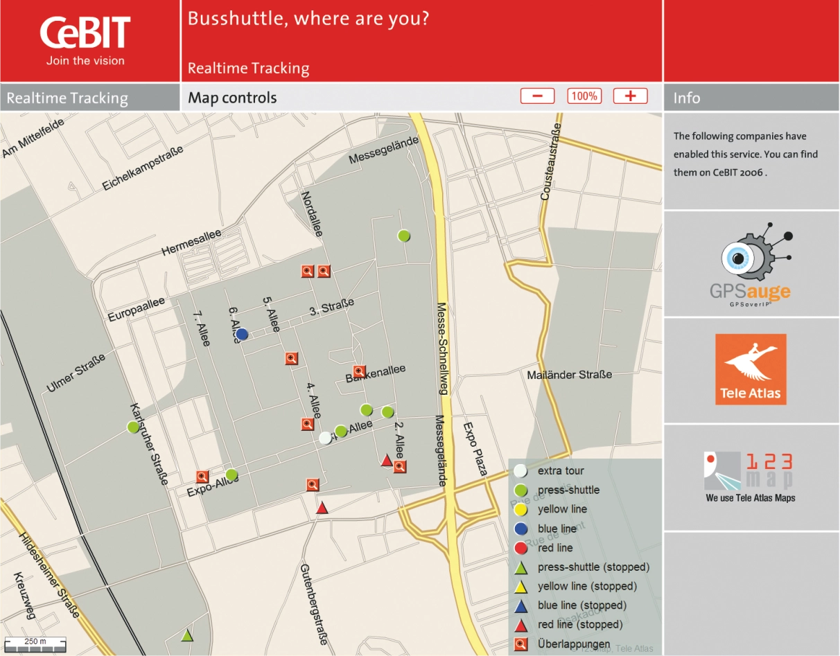
Interactive smartphone application for real-time tracking of trade fair buses for visitors
Coca-Cola Christmas Trucks 2005
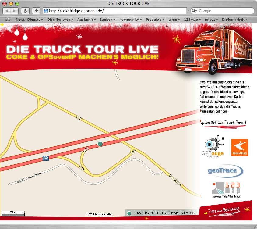
Interactive map for tracking the traveling Coca-Cola Christmas trucks in the browser (2005)
Rossmann store search
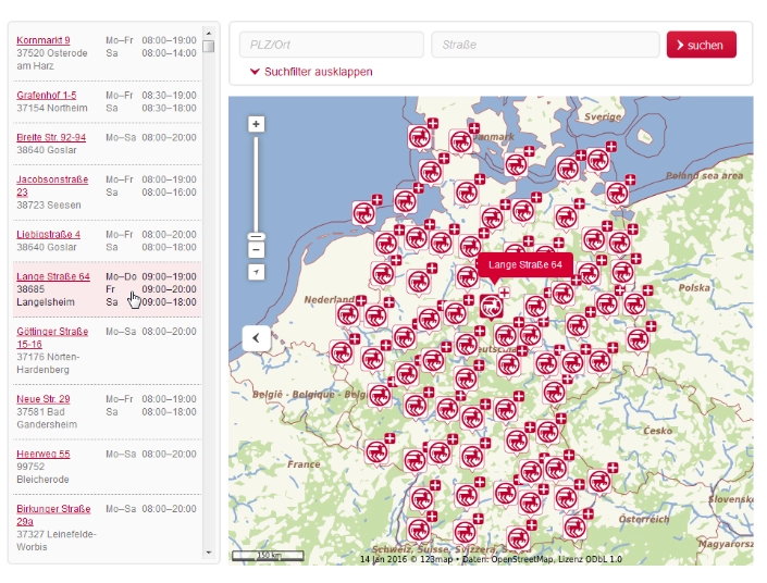
Interactive store search with daily, automated updates on opening hours, new openings, product range, etc.
Metro-Lion
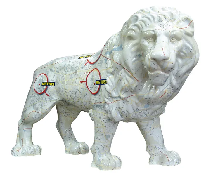
From the early days of our range of vector-based maps (at that time still with TeleAtlas data) is this life-size lion, which was foiled with a map of Munich.
City Map Cab
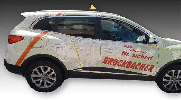
Cabs in Austria wrapped with a city map