Our Reverse Geocoding Engine
For many tasks, reverse geocoding offers an excellent way of using interactive maps more intuitively and making suitable information accessible in a playful way.
What is Reverse Geocoding?
Reverse geocoding involves a pair of coordinates for a specific point on a map. This type of geocoding can be used to assign information to this point that is located in its surroundings.
A practical and frequently occurring example of this is the return of an address for a coordinate. In this case, a street name, a house number, a town, a municipality, a district and so on are appended via this process.
Customizable to your task
With our reverse geocoder, information on any geometries defined in the map can be adapted to such a "point search". For example, if you want to determine the distance to the nearest highway exit after clicking on a map, this is just as possible as displaying the nearest mailbox or the nearest bakery. Everything can be adapted exactly to your needs.
Example of use
Below we illustrate the use of reverse geocoding using a use case from our projects.
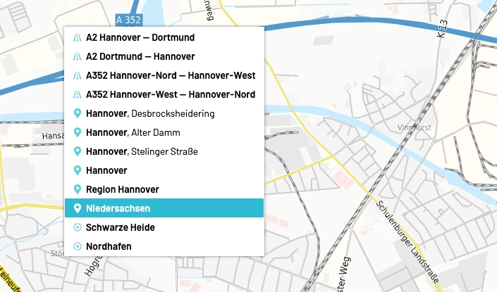
The user clicks with the right mouse button in a selected area of the base map. The system determines the coordinates of the mouse click and transfers them to the reverse geocoding process.
The results are then immediately displayed in a previously defined selection box. They show the nearest towns, the nearest highways and so on. After clicking on a highway, a new map view with the result of the query and a corresponding selection band opens, as in the example here.
It is clear how much this procedure simplifies the processes.